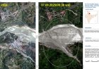


ISRO assesses Dharali damage post flash flood
The space agency said the findings include indications of flash flood, with widened stream channels, altered river morphology and damage to human lives and infrastructure
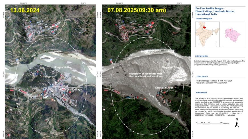
The Indian Space Research Organisation’s (ISRO) National Remote Sensing Centre has done a “rapid assessment” of the damage caused by the flash floods in Uttarkashi district of Uttarakhand using very high-resolution images from the Cartosat-2S satellite.
“The comparative analysis of satellite images of 07.08.2025 (post-event) and available cloud-free pre-event data (13.06.2024) revealed the extent and severity of the destruction,” ISRO said.
What's Your Reaction?
 Like
0
Like
0
 Dislike
0
Dislike
0
 Love
0
Love
0
 Funny
0
Funny
0
 Angry
0
Angry
0
 Sad
0
Sad
0
 Wow
0
Wow
0